
To the Top and Back! a Hike up an Active Volcano
If you like the awesome bang and crackle of fireworks, then I am sure you would love to see a real volcano blow its top even more! But from a safe distance right? After all, a dark gray column of gas, rock, and ash, going up 15 miles into the sky is an amazing display of God’s power! Psalm 104:32 says, “He looketh on the earth, and it trembleth: he toucheth the hills, and they smoke.” Or are you the kind of kid who would want to climb a volcano, maybe even an active one? Well, you’re welcome bring your imagination along with Shayne, an 11-year old girl, and Rylie, her 9 year old brother; who just climbed an active volcano called Mount Saint Helens in the state of Washington. Since volcanoes are found all over the world, maybe you can find one near you to climb someday!
Although there are many active volcanoes (those that have recently erupted), most volcanoes that you could climb are extinct, meaning it’s not really capable of erupting anymore; or dormant, meaning they haven’t exploded in a very long time. Erupting is a word used by volcanologists; they are special geologists who study volcanoes. Erupting is what volcanoes do best; either by slowly spewing out lava (hot, molten rock) or by exploding in giant clouds of gas, rock, and ash. An active volcano could be erupting today, this month, this year; or it could just be getting ready. When it comes to active volcanoes it’s always best to consult one of these experts before you climb, to make sure it is safe and that you know the rules.
At Mount Saint Helen’s that means getting a pass from the rangers before you climb above where the forest ends. You surely wouldn’t want to be on the mountain when it next explodes like it did the morning of May 18, 1980. Your parents might remember that day! Scientists had been monitoring the volcano since March of that year when many small earthquakes shook the mountain and small eruptions of steam, ash, and rock began to occur. They did their best to warn people not to go near the mountain as they began collecting information that would help them better predict eruptions in the future and save lives.
On that day, Mount Saint Helens blew up with the same force as 440 million tons of dynamite, or the equivalent of one atomic bomb every second for a full 9 hours! But not today, it is nice and sunny, and should be fairly warm for a typical spring day. There are clouds, but they are patchy and we should be able to climb above them. There has been a lot of snow over the past winter, so we will need to make sure we have proper gear for our climb, including tough shoes with good traction and even ice axes! Some food, water, and proper clothing are also essential. Since the mountain completely blew out the north side and not just the top, we will be hiking up the south side of the mountain, straight up, to the rim of the crater.
Lava, Lahars, and Canyons
We start out in a forest filled with pine and fir trees. The early morning light casts mottled shadow and patches of sun around us. Here, near the base of the mountain, at an elevation of about 2,650 feet above sea level, is evidence of a much older, and very different type of eruption. Right about the time Paul was sailing around the Mediterranean on his missionary journeys, almost 2,000 years ago, Mount Saint Helens was slowly erupting lava in a Pahoehoe type eruption. Think of cold syrup flowing into the squares of your breakfast waffles; only this is hot lava flowing slowly around the trees and then hardening into rock. As the trees died and rotted away, spooky holes are left in the rock where they used to be. Volcanoes that only erupt with this kind of slow eruption are called shield volcanoes and they have broad, gentle slopes. Although Mount Saint Helens has some eruptions like this, it is a strato-volcano, which means it has very steep sides and explosive eruptions most of the time.
Not too much further up, around 3,700 feet of elevation, the forest opens up as the trees begin to thin out and get smaller and smaller as conditions for growing become more difficult. The hike is getting more difficult and steeper now too! We are no longer walking along the soft forest floor with its thick carpet of pine needles, now we are beginning to scramble around larger rocks and small boulders. It is here we also pass Chocolate Falls. Disappointingly, it is not named that because sticky, sweet goodness is flowing down the mountain! Here Swift Creek drops into a small canyon, cut through dark gray-brown rock, the color of chocolate. This is just a small example of the destructive power of water to cut into solid rock.

Swift Creek Canyon at Chocolate Falls, both formed by catastrophic processes.
Elsewhere on the mountain, there are many other canyons that have been formed very rapidly, by catastrophic processes following eruptions. Today, Loowit Falls tumbles 186 feet into its canyon, giving geologists a better understanding of how canyons, including the Grand Canyon, can form very quickly. But just how did this happen? First, the eruption of 1980 began with an earthquake and massive landslide, unleashing all the rock that had been holding back the rising magma. The entire top and north side of the mountain went cascading down into Spirit Lake. It actually pushed out the water in the lake, in a giant wave of water 860 feet high, that collided with the surrounding ridges before forming a new lake about where the old one had been. Lahars, or pyroclastic flows; are a muddy mix of ash, rock, and water, that flowed down the mountain at up to 200 miles per hour and 1200 degrees Farenheit! One million trees were cut down. 200 square miles of forest were gone in just a few minutes. Along with the falling ash from the eruption, up to 600 feet of new strata (rock layers) were deposited by these lahars. Some of the debris created huge dams that held back the 46 billion gallons of instantly melted snow from the top of the mountain. The day after the eruption, these dams began to break, and a wall of water 200 feet high rushed down the Toutle River, causing massive flooding and devastation. In a matter of days, all of that rushing water rapidly cut through the new sediments and into solid rock, creating deep canyons around the mountain. This is how Loowit Canyon was formed.
At the 4800 feet elevation, which is about the tree line, the trees disappear completely, giving way to rock and snow. You could imagine that you were on a different planet! The rough, dark colored rocks range in size from large boulders to fine ash. The melting snow makes the ash muddy and slippery. Also, the mountainsides are steeper here, making upward progress a little more difficult. We are now entering what are called the “Worm Flows”. These long, narrow ridges of rock look much like worms, bending and flowing down the mountain. They are a frozen river of lava, turned into solid rock as the flows cooled. We choose to hike along the side of one of these wormy ridges, following it up the mountain and avoiding the snow in between. With all this rock around, we geologists start to get very excited! The Worm Flows continue all the way up to Monitor Ridge at 6900 feet elevation.
The Worm Flow ridges, which run downhill and tend to melt out of the snow first in summer.
Predicting Eruptions
Monitor Ridge is so named because here they have sensitive scientific instruments that send data back to the scientists using radio communication. These instruments help them predict eruptions and are located in several places around the mountain. A seismograph sensor, buried under the rock, records the mountain shaking. These earthquakes occur as pressure and heat push magma (a mix of gas and molten rock that hasn’t yet erupted) upwards, fracturing the rock and creating openings. If lots of fractures are forming, then it is called an earthquake swarm. Increasing frequency of earthquake swarms, and large earthquakes, indicate that the mountain is waking up and getting ready to erupt. The other instrument, a GPS monitor, or Global Position System, uses multiple satellites to measure very precisely where on earth the monitor is located. These GPS readings can be accurate to much less than an inch! As earthquakes occur, and magma is forced upwards, the volcano grows and the GPS monitors how much and how quickly the mountain is growing. Just like more earthquakes, more movement, means an eruption is on the way! Thankfully all was quiet leading up to our hike.
Before the eruption, Mount Saint Helen’s was anything but quiet and gave off multiple signals that something big was about to happen. Three months before the main eruption, the mountain began to experience earthquake swarms. The first big earthquake swarm lasted several days and produced a couple hundred earthquakes big enough to feel. In the week before the main eruption, earthquakes big enough to start causing damage happened at a rate of eight each day! The moving magma that caused these earthquakes created a bulge on the side of the mountain called the Goat Rocks Dome, that grew as much as 8 feet per day during this time. That is taller than you or your parents every day! As the magma moved upwards, it heated up underground water from melted snow, creating steam. This steam exploded in what are called phreatic explosions, a sure signal of an impending eruption.
At Monitor Ridge we met another geologist and some volunteers who are ready to help, and could even radio in for a helicopter if someone gets hurt. From these stations on up, our hike will be up the Swift Glacier. A glacier is a slow-moving river of snow that doesn’t fully melt in the summer. Time to strap on the crampons (spikes that strap onto your shoes and dig into the snow and ice so you don’t slip). Grab the ice ax and let’s go! The mountain gets even steeper from here on, so it is even slower going, but we had an early morning start and are determined to reach the top! From below, all you can see is mountain and sky, so several times, what we think is the top turns out to just be another ridge, called a false summit. On we plod when we see that the rim is still above us.
Watch Out Below!
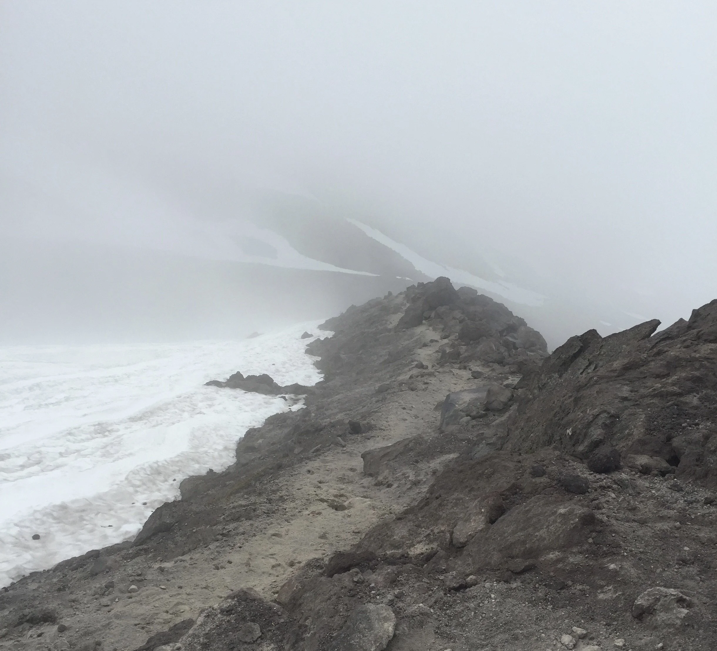
Finally, the top! At 8,363 feet above sea level, we are now standing on the crater rim! We are at the top of an active volcano, but we still don’t have a very good view inside because we can’t go to close to the edge. The snow is built up over thin air and if we stepped out on that, what is called a snow cornice, it could break and we would tumble about 1,000 feet down into the crater below. We move around to where there is bare rock at the edge and there it is!
We can see the crater, it is about 1.5 miles in diameter and U-shaped. It opens to the north where most of the blast escaped out the side of the mountain. Inside we can see a new dome growing, a mini-volcano inside the old volcano. In fact, there are two domes, one that built up in the 6 years after the main eruption, and another that began in 2004. In a short six months, this new dome grew past the height of the Empire State Building, over 100 stories high! New rock was being extruded at a rate of a small dump-truck load every second. Someday, this new dome may fill-up the old crater, grow to new heights, and eventually erupt in a major explosion again.
Standing here at the rim in the sun, I try to imagine what happened here when 1,300 feet above where I am standing just disappeared. When the mountain collapsed in that massive landslide, all the weight holding back the magma and gas was released and 400 million tons of ash was blown 15 miles into the sky, in a roar heard over 200 miles away. Actually, in the quiet of today, it is hard to image all the destruction that was un-leashed. The explosive power of nature is amazing, but it is nothing compared to the awesome God of the universe who created it.
Before we head back down, we get a glimpse through the clouds of some of the other volcanoes nearby. To the north is Mount Rainier, and to the south is Mount Hood. These are part of the Cascade Volcanic Arc, a name for the 700-mile long string of volcanoes from Canada to California with Mount Saint Helens roughly in the middle. The Cascade Volcanic Arc is itself, just a small segment of the volcanoes that encircle the entire Pacific Ocean known as the Pacific Ring of Fire. Many of these volcanoes are active.
Well, it was a long hike up and now it is time to head back down. For that, we are actually going to sit down and slide on the snow. Since Mount Saint Helens is a strato-volcano, the very steep sides make for a difficult climb up, but the steepness is perfect for sliding down on! Our ice axes we can use as brakes to slow us down if we need to. This sliding is called glissading and is so much fun! We made it all the way back down to Chocolate Falls in less than an hour, just by sliding on our rears. If you want to see just how much fun it is, maybe your parents might be able to find a go-pro video on YouTube. Better yet, you could start planning your own trip together and exercising together to get ready.
We Survived!
Well, we made it safely back and all thanks to God. As we follow Him through life’s adventures, He will protect us. Psalm 91:11-12 says “For he shall give his angels charge over thee, to keep thee in all thy ways. They shall bear thee up in their hands, lest thou dash thy foot against a stone.” If you’re near a volcano someday when it erupts, remember, He will protect you always!

A view of the Mt. St. Helens crater from the south room, looking north across the new dome growing in the middle.